UK Location (INSPIRE)
Type of resources
Available actions
Topics
Keywords
Contact for the resource
Provided by
Years
Formats
Representation types
Update frequencies
Service types
Scale
Resolution
-
A card index storing supplementary information regarding name, operator, dates and commodity worked for each planning permission boundary recorded (drawn) on the Ministry of Housing and Local Government (MHLG) Mineral Planning Permissions Maps (see associated metadata). Information on the cards has been used to attribute the Ministry of Housing and Local Government (MHLG) Mineral Planning Permission Polygons (see associated metadata for MHLG Planning Permission Polygons).
-
The BGS Debris Flow Susceptibility Model for Great Britain v6.1 is a 1:50 000 scale raster dataset of Great Britain providing 50 m ground resolution information on the potential of the ground, at a given location, to form a debris flow. It is based on a combination of geological, hydrogeological and geomorphological data inputs and is primarily concerned with potential ground stability related to natural (rather than man-made) geological conditions and slopes. The dataset is designed for those interested specifically in debris flow susceptibility at a regional or national planning scale such as those involved in construction or maintenance of infrastructure networks (road or rail or utilities), or other asset managers such as for property (including developers and home owners), loss adjusters, surveyors or local government. The dataset builds on research BGS has conducted over the past 15 years investigating debris flows. The model was designed to identify potential source-areas for debris flows rather than locate where material may be deposited following a long-run-out failure i.e. the track and flow of debris. This work focuses on natural geological and geomorphological controls that are likely to influence the initiation of debris flows. It therefore, does not consider the influence of land use or land cover factors.
-
Contains digitised mine plan contours, spot heights and worked ground outlines on key coal seams from the Midland Valley in ASCII or ArcView format. Incomplete, only some seams and some areas digitised. All contours digitised on key seams, worked ground outlines simplified, spot heights digitised where no contours exist.
-
The joint PHE-GSNI-BGS digital Radon Potential Dataset for Northern Ireland provides the current definitive map of radon Affected Areas in Northern Ireland. The Radon Potential map for Northern Ireland shows the estimated percentage of homes in an area exceeding the radon Action Level. This is the basic information to assigning the level of protection required for new buildings and extensions, as described in the Building Research Establishment guidance BR-413 Radon: Guidance on protective measures for new dwellings in Northern Ireland (2004). The Radon Potential map for Northern Ireland is based on PHE indoor radon measurements and 1:10 000 or 1: 250 000 scale digital geology information provided by the Geological Survey of Northern Ireland (GSNI). The indoor radon data is used with the agreement of the Northern Ireland Environment Agency and PHE. Confidentiality of measurement locations is maintained through data management practices. Access to the data is restricted. Radon is a natural radioactive gas, which enters buildings from the ground. Exposure to high concentrations increases the risk of lung cancer. Public Health England (PHE) recommends that radon levels should be reduced in homes where the annual average exceed 200 becquerels per cubic metre (200 Bq m-3), the Action Level. PHE defines radon Affected Areas as those with 1% chance or more of a house having a radon concentration at or above the Action Level. Further information on radon can be obtained from www.ukradon.org
-
Data from projects that investigated the migration, transport and retardation processes of naturally occuring trace elements, as analogues the behaviour in the geosphere environment, of radionuclides from radioactive wastes. Study sites included: the Quaternary Broubster Peat Bog, near Thurso in Caithness (study of the migration behaviour and characteristics of U, Th, Ra, Pb, Cu, Zn, organic complexes such as fulvic and humic acids); the Needle's Eye site (Quaternary estuarine and marsh/mudflat sediments) on the Solway Coast of Dumfries and Galloway (study of the migration and retardation behaviour of U in Quaternary sediments and fractured Palaeozoic source rocks); Study of U geochemistry and transport behaviour from uranium-rich mine wastes at the South Terras Mine site, near St Austell, Cornwall; Study of the geochemistry of diffusion of Cl and I from marine source sediments into lacustrine sediments in Quaternary sediments from Loch Lomond. Data consists entirely of published reports of geological, geochemical, hydrochemical petrological and mineralogical information. The data includes descriptive and numerical data but is not digitally available in its present state.
-
This national dataset brings together sixteen national datasets to create a GIS product that provides the information necessary to determine the extent to which the ground is suitable for infiltration sustainable drainage systems (SuDS). It includes derivations of the following datasets: soluble rocks, landslide hazards, groundwater flooding susceptibility, made ground, shallow mining hazards, geological indicators of flooding, depth to water table, superficial thickness, compressible ground, collapsible ground, swelling clays, running sands, predominant flow mechanism, permeability indices and the Environment Agencys source protection zone dataset. All datasets have been reclassified and reattributed (with text descriptions and a score field indicating the suitability of the ground for infiltration) and feature in the end product both as single entities, but also in derived 'screening' maps that combine numerous datasets.
-

A core scanning dataset from part of the Ellesmere Port-1 drill core that was drilled for unconventional hydrocarbons in 2014. Approximate 40 m of core from the Bowland Shale Formation in the Ellesmere Port-1 (1532.7 – 1663.15 m) was scanned for high-resolution optical images and X-ray fluorescence (XRF) downcore point measurements using the Itrax MC core scanner (Cox Analytical Systems) at the Core Scanning Facility (CSF) at the British Geological Survey. Core scanning was utilised as part of the commission phase of this facility.
-
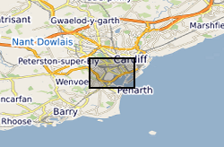
Groundwater temperature data from a shallow urban aquifer in Cardiff, Wales, UK between 2014-2018. Monitoring was undertaken as part of the ‘Cardiff Urban Geo-Observatory’ project . Boreholes are located within the urban area of the City of Cardiff, Wales, UK. The majority of temperature sensors were installed within boreholes that monitor a shallow Quaternary aged sand and gravel aquifer, however the made ground and the Triassic Mercia Mudstone also represented. Temperature sensors installed in 53 boreholes, between depths of 1.5m and 12- m below ground, with measurements every 30 minutes. The dataset comprises of just over 3.5 million temperature measurements. Monitoring was undertaken by the British Geological Survey and was designed to address knowledge gaps of subsurface urban heat island and it use for heat recovery and storage. Metadata Report http://nora.nerc.ac.uk/id/eprint/525332/
-
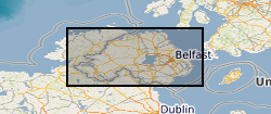
The 1:250k Geological Maps of Northern Ireland comprise the Superficial Deposits Map (Drift, 1991) and the Bedrock Map (Solid Geology, 1997). These maps identify landscape areas based on their lithology. The scale of the maps is 1:250 000 and provides a simplified interpretation of the geology that may be used as a guide at a regional level, but should not be relied on for local geology. Superficial deposits are younger geological deposits formed during the most recent geological time; the Quaternary. These deposits rest on older rocks or deposits referred to as bedrock. The superficial deposits theme defines landscape areas with a geological name and their deposit-type or lithological composition. The Superficial map shows the deposits within the extent of the six Counties of Northern Ireland. The Bedrock map comprises the bedrock geology and contains dykes and geological faults. Bedrock geology describes the main mass of solid rocks forming the earth's crust. Bedrock is present everywhere, whether exposed at surface in outcrops or concealed beneath superficial deposits or water bodies. Geological names are based on the lithostratigraphic or lithodemic hierarchy of the rocks. The lithostratigraphic scheme arranges rock bodies into units based on rock-type and geological time of formation. Where rock-types do not fit into the lithostratigraphic scheme, for example intrusive, deformed rocks subjected to heat and pressure resulting in new or changed rock types; then their classification is based on their rock-type or lithological composition. This assesses visible features such as texture, structure, mineralogy. Dykes defines small, narrow areas of a specific type of bedrock geology; that is igneous rocks which have been intruded into the landscape at a later date than the surrounding bedrock. Geological faults occur where a body of bedrock has been fractured and displaced by large scale processes affecting the earth's crust (tectonic forces). The Bedrock map shows the main bedrock geological divisions in Northern Ireland and coverage extends to the west into the Republic of Ireland. The printed map includes a stratigraphic column. Digital datasets have been derived from the maps and comprise three layers. 1. Superficial polygons, 2. Bedrock polygons and 3. Linear features. Attribute tables describe the polygon features. These data are generalised and superseded by the 1:10k Geological Maps of Northern Ireland.
-
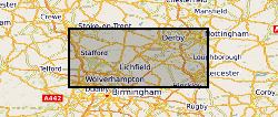
The full title of this project is" Studies into metal speciation and bioavailability to assist risk assessment and remediation of brownfield sites in urban areas" and is funded by NERC under the URGENT thematic programme form 1998-2001. The project is being undertaken by a consortium of workers from the Imperial College, University of Nottingham, and the British Geological Survey. Innovative collaborative and multi-disciplinary research will be applied to the interpretation of urban geochemical maps and associated meta-datasets to assist decision making by local authorities in the redevelopment of brownfield sites. Source apportionment, speciation and bioavailability of potentially toxic heavy metals will be studied at representative conurbations in the UK Midlands region. Scanning electron microscopy, chemical extractions and soil solution and vegetable analysis, will be integrated with high precision isotopic analyses of Pb and other potential toxic metals in this study. The results will be available as maps in GIS format to provide a generic decision support system for quantitative health risk assessment.
 NERC Data Catalogue Service